

From short woodland loops to hikes beneath the towering trees of the Forest Cathedral, discover Cook Forest on foot this winter. Our guide includes trail distances, difficulty levels, and practical tips to help you choose a route that suits your pace and the conditions.
Cook Forest has plenty of winter trails to venture. DCNR rates Longfellow as “more difficult,” while Black Bear, Tom’s Run, Birch, and the Sensory Trail are “easiest.” We listed the trails distinguishing trail lengths from total walking distances so you can plan your trip.

The ratings below are DCNR’s hiking ratings. Snow and ice can make even an “easiest” trail more demanding.
Cooksburg Dry Goods Gift Shoppe offers rentals for cross country skis, snow shoes and more.
| Trail | Difficulty | Listed trail length* | Experience and useful planning information |
|---|---|---|---|
| Sensory Trail | Easiest | About ¼-mile loop | A short, paved woodland route with benches, a guide cable, and tactile signage. Access is near the Sawmill Center for the Arts, via the water tower access road. Designed for accessibility; check snow and ice conditions before visiting. |
| Black Bear Trail | Easiest | 1.1-mile loop | A flat woodland walk beginning and ending at the Sawmill Center for the Arts. A useful choice for visitors who prefer a straightforward loop. |
| Tom’s Run Trail | Easiest | 0.8-mile connector | A flat route through Tom’s Run Valley between the Log Cabin Environmental Learning Center and the swinging bridge. Plan your return route and take extra care on icy bridge surfaces. |
These three options offer shorter or gentler outings, subject to winter conditions.
| Trail | Difficulty | Listed trail length* | Experience and useful planning information |
|---|---|---|---|
| Birch Trail | Easiest | 0.9-mile linear trail | Runs between the Children’s Fishing Pond and Shelter 1. A pleasant choice for a woodland walk; use the park map to plan connections around the swinging bridge and Tom’s Run. |
| Longfellow Trail | More difficult | 1.2-mile linear trail | A classic Forest Cathedral experience among old-growth pines and hemlocks. Begins beside the Log Cabin Environmental Learning Center and ends at Forest Road. Allow for the return journey or a mapped connecting route. |
| Cook Trail | More difficult | 2-mile loop | Combines forest scenery with logging-era history, including a CCC dynamite shack. Access points include the River Picnic Area, River Cabin 12, and a spur from Cemetery Road. Confirm winter access before choosing your starting point. |
These are good additions for visitors seeking more walking distance or an old-growth forest experience.
* Distances describe the named trails, not necessarily your entire outing. Retracing a linear trail doubles its distance; connecting trails and approaches from parking add mileage.
An option for experienced winter hikers: Seneca Trail is rated “most difficult” and has a listed length of 0.9 mile. It climbs from PA 36 toward Deer Park Trail through old-growth forest, with views of the Clarion River. Its steep terrain deserves particular caution when icy. pa.gov
Include these practical winter tips alongside the listings:
- Check access before driving. Ask about road closures, usable parking, and available restrooms. Contact Cook Forest State Park at 814-744-8407. Day-use areas close at dusk, and cell service can be unreliable, so download your map beforehand. pa.gov
- Bring winter footwear and traction. Waterproof boots, traction devices, layers, water, snacks, and hiking poles can help make the outing more comfortable. Leave your route and expected return time with someone.
- For cross-country skiing, check the designated routes. DCNR identifies Fire Tower Road, Tom’s Run Road, and part of Forest Drive as groomed ski routes. Confirm current snow coverage and grooming before visiting. Tom’s Run Road and Tom’s Run Trail are different routes.
- For snowshoeing, follow conditions and trail etiquette. DCNR recommends at least four inches of snow and asks snowshoers to stay out of established cross-country ski tracks.
As always, we recommend following DCNR’s safety guidelines for your next adventure, including for activities like cross-country skiing, snowshoeing, hiking, ice skating, and horseback riding.
Useful links for your article: Cook Forest trail maps and the Pennsylvania State Parks Winter Report.
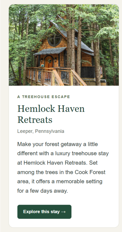
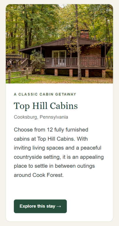
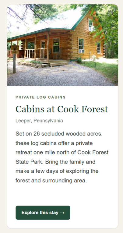
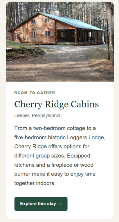
8 Cozy Places to Stay in the Cook Forest Area
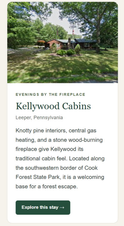
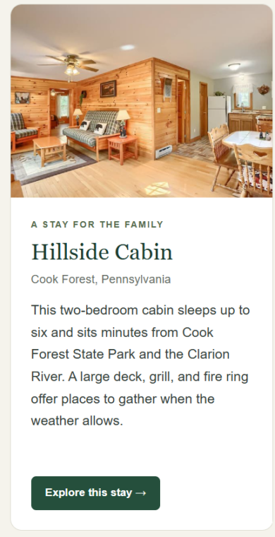
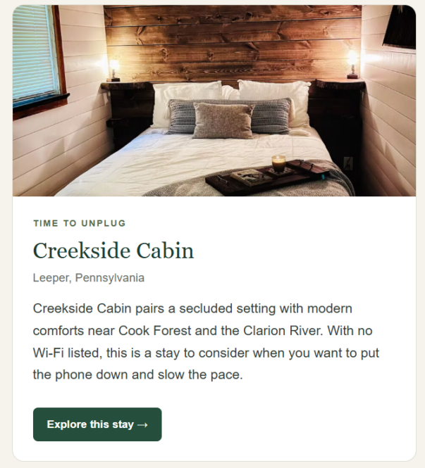
After a day on the trails, settle into a cabin and give yourself another day to explore. From a treehouse tucked among the trees to a lodge with room for friends and family, these eight stays offer different ways to enjoy a Cook Forest getaway.

Follow us on social to stay informed with the latest happenings and special deals.
Latest Blog Articles
- Fall Smallmouth Fishing on the Clarion River: A Clarion County Day Trip
- Winter Trails in Cook Forest – Clarion Area
- Winter Getaway to Cook Forest: Secluded Cabins, RV Sites & Outdoor Adventure
- Ghosts, Graveyards, and Ghouls: A Spooky Season in Clarion County
- Discover Cook Forest’s Ancient History: A Fall Visitor’s Guide